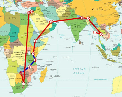
Okay, just because I was bored and had nothing better to do with my time, I made this map that shows all the places I'm going. Each of the circles with a number in it is a place I'm stopping, the red lines are routes I'm traveling by air, and the blue lines are routes I'm traveling overland. This is just the plan, of course, and it assumes that I won't come down with dengue fever or be taken as a political prisoner or anything like that.
Monday, May 26, 2008
Mapping it Out
Subscribe to:
Post Comments (Atom)
0 comments:
Post a Comment